Coordinate
Advertisement
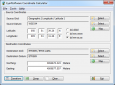
Coordinate Calculator v.2 2
Coordinate Calculator is a geodetic coordinates calculator. Coordinate Calculator calculates Lat/Lon coordinates to/from coordinates in different projection, local datums (264 datums) and on different spheroids(33 spheroids).
Advertisement
TatukGIS Free Coordinate Calculator v.1.2.3.34
This free Windows application interactively converts the coordinates of a point between coordinate systems. The version 2 reflects the same coordinate system support as the TatukGIS Developer Kernel (v.9) and TatukGIS desktop Editor (v.
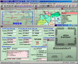
GISEYE Coordinate Converter v.3.1
GISEYE Coordinate Converter program is designed for conversion of coordinates from one map projection into another. List of coordinates and map projection parameters are specified by the user.
Mofikis Coordinate Finder v.inder 1.0.47.6
Find screen coordinates within any window or your desktop. This Coordinate finder was developed by me in the hopes that others can use it to develope macros that require screen coordinates along with giving coordinates for website image mapping.
TRANSDAT v.20.37
TRANSDAT Coordinate Conversion supports thousands of coordinate systems and geodetic datum shifts, user-defined systems, INSPIRE, NTv2, BeTA2007, GPS, continental drift, Shape, KML, CSV and other file systems and much more with highest accuracy.

Eye4Software GPS Toolkit for Java v.4.0
Java toolkit to add coordinate conversion functionality to software (GPS API). Support for datum conversions and coordinate conversion using different map projections.

TRANSDAT English v.17.75
TRANSDAT Coordinate Conversion supports thousands of coordinate systems and geodetic datum shifts, user-defined systems, INSPIRE, NTv2, BeTA2007, GPS, continental drift, Shape, KML, CSV and other file systems and much more with highest accuracy.
TuCSoN v.1.10.3.0206
TuCSoN, also known as Tuple Centres Spread over the Network is a model with related infrastructure and technology that helps coordinate Internet agents.
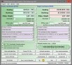
TOPOWIN English v.13.00
TOPOWIN is a state-wide register of the German topographic cartographies and of localities with geo references in different coordinate systems. It also is a topographic information system.

GeoDLL Deutsch v.14.60
GeoDLL supports the development of geodetic software on various platforms by providing geodetic functions. GeoDLL contains precise calculations on the themes 2D and 3D coordinate transformation, geodetic datum shift and reference system and more.
GeoDLL English v.14.60
GeoDLL supports the development of geodetic software on various platforms by providing geodetic functions. GeoDLL contains precise calculations on the themes 2D and 3D coordinate transformation, geodetic datum shift and reference system and more.